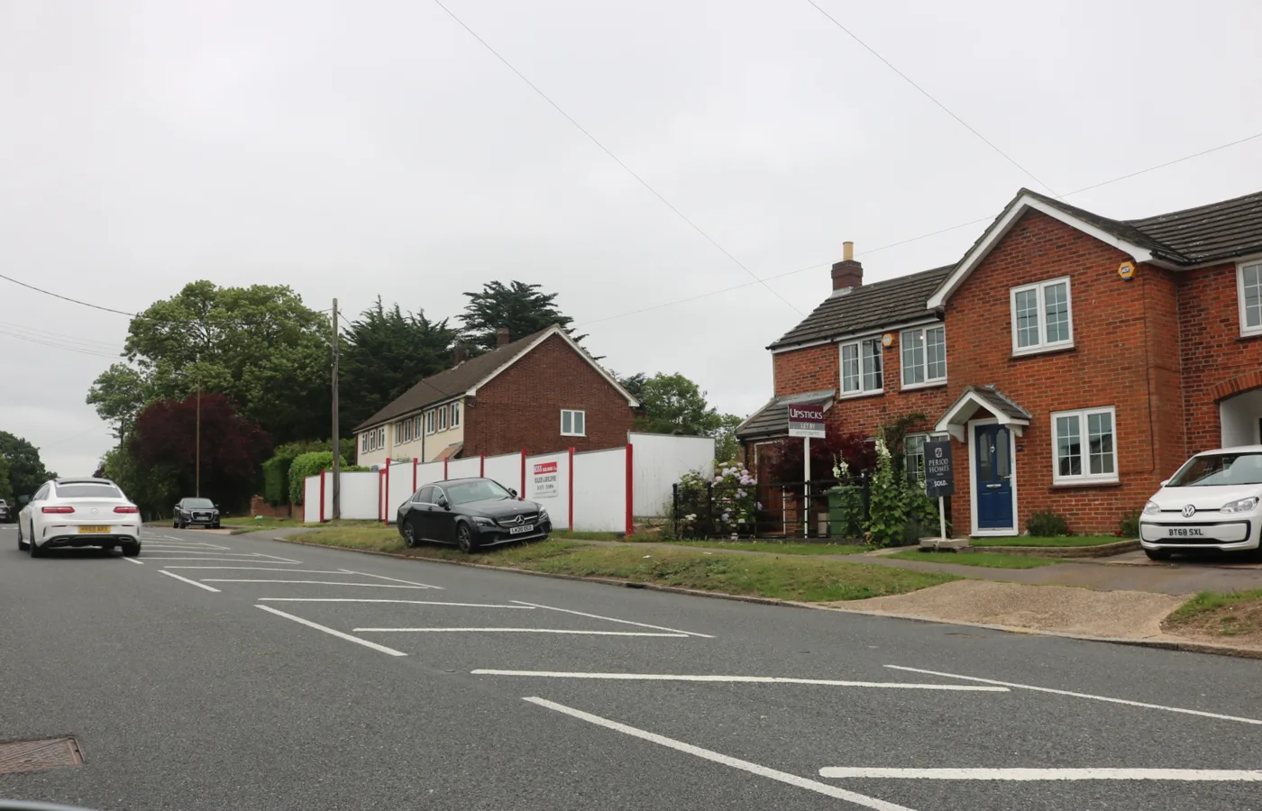

Taylor Wimpey has resubmitted plans for 60 homes on Green Belt land south of Roman Road, Mountnessing, half of them affordable. Comments close 25 October.
Taylor Wimpey has applied again to build 60 homes on Green Belt land south of Roman Road in Mountnessing. Its first attempt, for 63 homes, was withdrawn in January after council officers raised design concerns.
The new application, 26/00977/FUL, was validated on 1 October 2026. Neighbours have until Sunday 25 October to comment, and the council’s target date for a decision is 31 December 2026 (Brentwood Borough Council planning register).
What is proposed
The site is a field of about 2.8 hectares on the eastern edge of the village. It sits between the houses on Roman Road and Hope Close and the A12, and is not in use. The plans include:
- 60 homes, 54 houses and a block of six flats
- 30 affordable homes, half of the total
- the demolition of 123 Roman Road to make way for the road into the site
- a central public open space with a small play area
- a footpath and cycle link to The Hillway, with bollards to keep cars out
- drainage ponds and a pumping station in the north east corner
The details come from the applicant’s planning statement and cover letter. The site area is from the council’s own pre-application advice, which the statement reproduces.
The mix of homes
The accommodation schedule lists every plot:
| Bedrooms | For sale | Affordable |
|---|---|---|
| 1 | 0 | 3 |
| 2 | 2 | 21 |
| 3 | 18 | 6 |
| 4 | 7 | 0 |
| 5 | 3 | 0 |
| Total | 30 | 30 |
All six flats are affordable homes. The schedule does not say how the affordable homes split between rent and shared ownership. The council’s policy asks for 86% affordable or social rent and 14% home ownership products.
How the scheme has shrunk
This is the third version of the plan:
- 72 homes at the first pre-application stage, in 2024 and 2025
- 63 homes in application 25/00981/FUL, withdrawn on 14 January 2026 “by agreement” with the council
- 60 homes now
Officers’ concerns about the withdrawn scheme included the entrance to the site, the size and look of the flat blocks, overlooking, and how usable the open space was. They also said there was no evidence of how the flats would affect views of the Grade II* listed Mountnessing Windmill, which stands a short distance north west of the site.
Taylor Wimpey went back to the council for further advice in February 2026. It also took the scheme to the Design South East review panel in June.
The council’s written advice of 26 May 2026 welcomed some of the changes: fewer homes, the flats moved away from the entrance and from neighbours, and a central open space. It also raised concerns:
- three-storey buildings “could not be supported”, as they are not the village’s character
- affordable homes were concentrated in the flat blocks, with “no equivalent” flats for sale
- the affordable mix was weighted towards two-bedroom homes, with no four-bedroom affordable homes
- the earlier application “attracted significant local concern”, and the applicant should explain what had changed in response
Those quotes come from the council’s letter, which is printed in full as an appendix to the planning statement.
The real argument: Green Belt and housing supply
The site is in the Metropolitan Green Belt. Taylor Wimpey argues it is “grey belt” land, a category in national policy that allows housing on weaker parts of the Green Belt. One of the tests is that there is an evidenced unmet need for the homes.
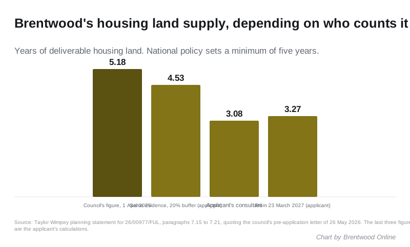
The council disagreed in May. It said it still had a five-year supply of housing land, at 5.18 years as of 1 April 2025, so there was no unmet need. On that basis, it said, the scheme would be “inappropriate development” in the Green Belt unless very special circumstances were shown.
The applicant says the arithmetic has since changed. From 1 July 2026, national policy adds a 20% buffer for councils whose adopted housing target is 80% or less of their assessed need. Brentwood’s Local Plan target is 456 homes a year, against a need of 713, so the buffer applies. The applicant calculates that this cuts the council’s own figure to 4.53 years.
A report by Emery Planning, submitted with the application, puts the supply lower still, at 3.08 years. The planning statement also says the figure falls to 3.27 years from 23 March 2027, when the council must measure against the higher need figure.
The council had not published an updated supply figure when it wrote in May. Its letter said the 20% buffer was “being discussed internally”. If its supply is below five years, national policy tilts the balance towards granting permission. That makes the council’s next figure as important to this application as anything on the plans.
What it means for you
- To comment, find 26/00977/FUL on the council’s planning register and use the comments tab. The neighbour consultation closes on Sunday 25 October.
- This is a new application. If you commented on the withdrawn scheme, comment again here so your view is on this file.
- Comments count most when they deal with planning matters: Green Belt, the windmill, traffic on Roman Road, drainage, design and the mix of homes.
- Officers or the Planning Committee will decide it. Committee dates and agendas are on the council’s meetings site.
Other live applications are in our Brentwood planning news.
Have your say