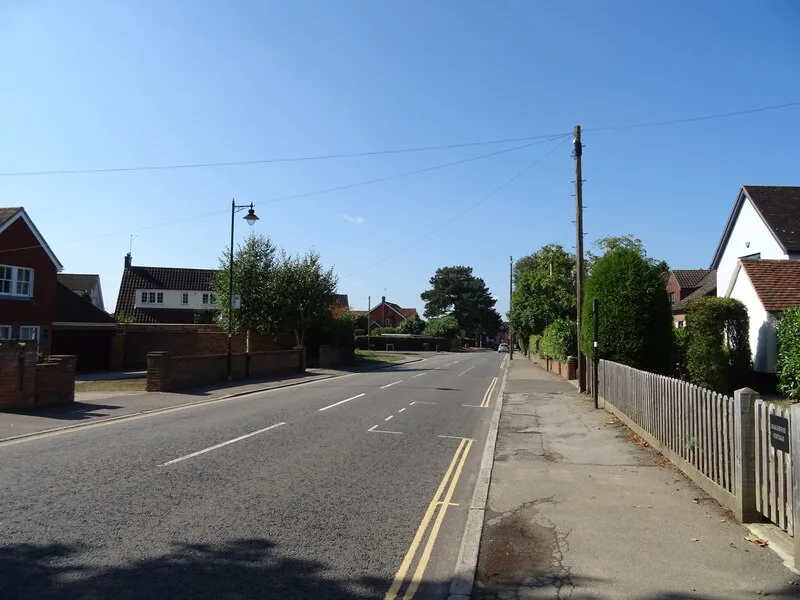

Brentwood's planning committee did not decide the 32-home Ingatestone High Street scheme on 13 October. Legal advice pulled it; officers backed it; 232 objected.
A plan for up to 32 homes on a horse paddock off Ingatestone High Street was taken off Brentwood Borough Council’s planning committee agenda on the day of the meeting.
The committee was due to decide outline application 26/00224/OUT on Tuesday 13 October. A note added to the agenda says it was withdrawn “following legal advice and a further review of the committee report”.
The council says “additional assessment and clarification are required in relation to certain material planning considerations”. The note does not say which ones. A revised report will come back to a future meeting.
Council officers had recommended approval. More than 230 objections were lodged against it.
The site and the scheme
The land sits on the eastern side of the High Street, south-east of the road and north of Docklands Avenue. The officer report describes it as:
- about 1.8 hectares, used for horse grazing, with a field shelter
- a 97-metre frontage onto the High Street, opposite Seymour Field
- a greenfield gap between houses at Parklands and Rookwood to the north and The Old Copper to the south
- bounded by Rays Farm Lane to the south and by Rays, a grade II listed farmhouse, to the east
- in the Green Belt, about 216 metres from the Ingatestone High Street conservation area
It is an outline application, so only the principle and the access are being decided now. The layout, the look of the houses, their size and the landscaping would come later.
The report sets out what the applicant offers:
- up to 32 homes, half of them affordable
- of the affordable homes, at least 80% for affordable rent and the rest shared ownership
- the existing field gate widened to about six metres as the single access
- the 30mph limit extended along the whole frontage
- a widened road with dropped kerbs and a pedestrian refuge, linking the northbound bus stop, Seymour Field and the Anglo European School
- the five veteran trees on the site kept and protected
Two trees, an ash and a Norway maple, and part of the front hedge would go to make way for the access.
Why officers backed it
Brentwood’s own pre-application advice said no. At that point the council could show a five-year supply of housing land, so new homes on this Green Belt field were “not supported”.
That changed on 1 July 2026. A 20% buffer now applies to Brentwood’s housing target, and officers say the council “cannot currently demonstrate a five year supply”. We covered the same shift in the 60-home Mountnessing application last week.
The report also treats the field as “grey belt” under the national planning rules published on 17 August 2026. Officers reason that Ingatestone is a village, not a large built-up area or a historic town. On that reading the land makes a weak contribution to the Green Belt purposes that count, so the scheme is not inappropriate development.
Officers accept that the homes would harm the setting of Rays. The council’s heritage adviser and the applicant’s adviser agree there is harm but not how much. The report weighs it against up to 16 affordable homes and the road safety works, and concludes the benefits win.
The section 106 terms in the report include £47,521 towards playing pitches, pools, sports halls and other sports facilities, and £476 per home towards protecting coastal wildlife sites. The figure for GP capacity was still “tbc”.
Who objected, and why
The council wrote to 68 neighbours. It received 232 objections, with some people objecting more than once.
Ingatestone and Fryerning Parish Council objects. Its response in the report makes these points:
- the field is open countryside that keeps Ingatestone separate from Fryerning, Mountnessing, Margaretting and Stock
- the site is neither allocated in the Local Plan nor designated as grey belt
- it conflicts with Policy 6 of the Ingatestone and Fryerning Neighbourhood Plan
- recent Redrow and Cala Homes schemes have already stretched GP surgeries, schools and local services
- traffic will get worse while the Anglo European School is rebuilt over the next few years
The parish council’s response cites the council’s January 2026 figure of a 5.18-year supply. The officer report says that figure no longer holds since the buffer changed in July.
Ward councillor Lesley Wagland called the application in to committee. Her objection says the site is not allocated, would set a precedent for further Green Belt release and would damage the setting of the Wid valley and the separate character of Ingatestone and Margaretting.
Essex County Council, as highway authority, raised no objection on road safety grounds, subject to conditions.
A 2016 outline application for 140 homes on the land next to this site was refused (16/01809/OUT), the report notes.
What happens next
The application has not been refused or approved. It stays open until the committee decides it.
Brentwood’s next planning committee is on Tuesday 24 November. The council has not said whether the revised report will be ready for that meeting.
What it means for you
- If you objected, the officer report summarises the 232 objections and they remain on the application file. Read them, and the plans, under reference 26/00224/OUT on the council’s planning portal.
- Agendas go up about a week before each meeting. Watch the planning committee page for the revised report.
- For other live schemes across the borough, see our Brentwood planning news page.
We will report the revised recommendation when it is published.
Have your say